Blog
DJI recently released the DJI Mini SE, a low cost updated version of the original DJI Mini at a lower...
When used in surveying drones are commonly used with one of three technologies, GCPs, PPK, RTK, to improve the GPS...
DJI has just released a V3 firmware update for the Matrice 300 RTK drone to improve the future updating process,...
What is a Subsea ROV? A Subsea ROV (remotely operated vehicle) refers to a passenger-less vehicle that operates underwater for recreational...
Rosie Bisset, a researcher at Edinburgh University, is mapping the surface of some of the highest glaciers in South America...
There are many questions asked around thermal payloads for drones. Teledyne FLIR has answered some of these questions below. Q: What...
Reaching data accuracy on your experimental fields requires to fly the right drone, at the right time, with the right...
UAV LiDAR integration is key to start a mapping business for safety reasons but not only (productivity, quality of deliverables…). Here...
With MicaSense's latest firmware update, customers with SkyPort versions of RedEdge-MX or Altum can now access high-quality and precise-geotagged multispectral...
Dronelife sat down with Jeff Foster, Co-Founder of Sound Visions Media, and Editorial Director of Drone Coalition to talk creating 3D models with a...
For large-scale surveying and asset management in remote areas, drone-based data collection is often the only option. Engineering services company...
Innolea, ex Biogemma, is a research company supporting the French oil industry, with activities focused on oil crop genetics and...
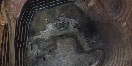
Freeport-McMoran, Inc. is a leading international mining company with headquarters in Phoenix, Arizona. Freeport-McMoran, Inc. is the world’s largest publicly...
Everything is fine until it’s not. Regular inspection of power lines is one of the first mandates of an energy...
GRTgaz, a subsidiary of Engie, is a natural gas transmission system operator. GRTgaz has over 4 400 delivery stations in...
Brand Wingcopter Autel Foxtech Model Wingcopter 198 Dragonfish Baby Shark Product Image Type VTOL VTOL VTOL Payloads Flexible 4k 20xZoom,...
DDT-31 is a French Department of Territory Management. DDT stands for Direction Départamentale des Territoires, with the "31" referring to...
To understand how drones can be utilised in surveying, let us remind you quickly about aerial photogrammetry. It involves taking...
Mill owners regularly inspect the surfaces inside paper tanks, looking for damage to the welds such as rust, scratching, or pitting...
Trees that are too close to power lines are a significant hazard and a major cause of power failures during...
After a traffic accident, first responders are faced with two simple questions: what happened and why? Accident reconstruction is all...
It took the team about three days to be fully operational with the UX11. They trained themselves by reading the...
Leading American air medical service provider Air Methods has launched its latest solution, Spright, a drone medical delivery service powered...
The world of smart farming brings precise inventories, harvest predictions and fast disease control to your fingertips. Find out three...
Interested? Talk to our team
For inquiries or more information, please fill out the form below, and our team will contact you as soon as we can.


