Everything is fine until it’s not. Regular inspection of power lines is one of the first mandates of an energy company - a task that is already benefiting from drone technology and is easy to carry out over smooth terrains and in mild weather conditions.
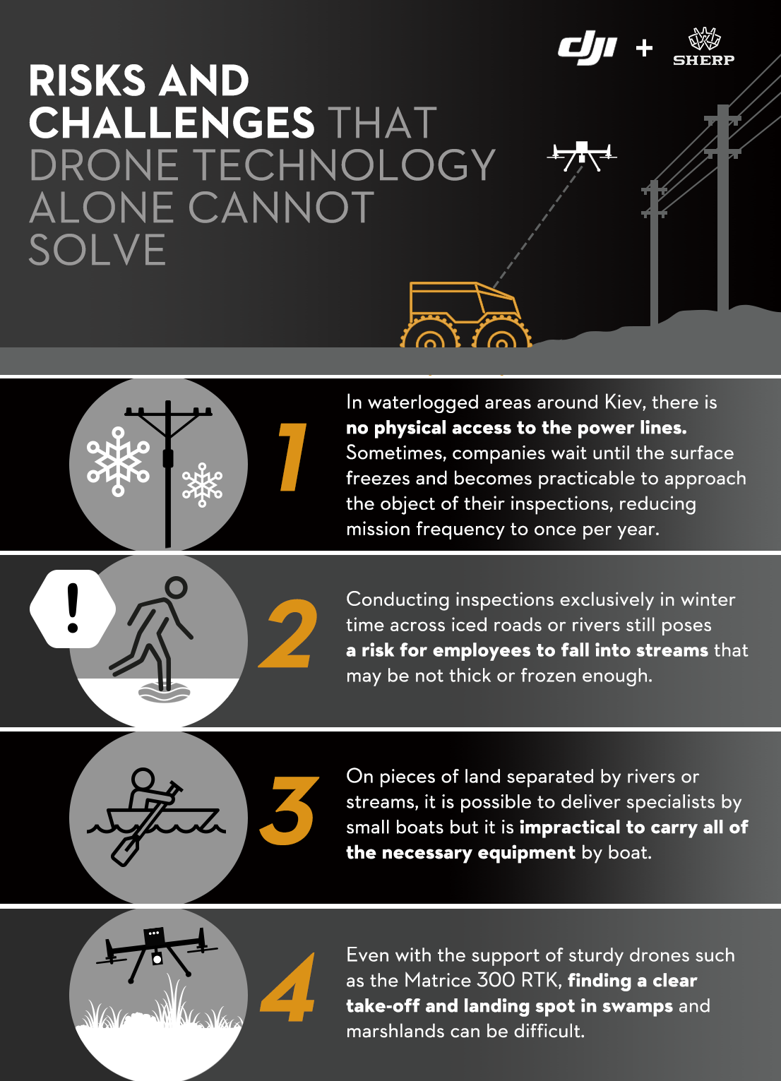
But often, hurricanes and floods can devastate entire areas, making them inaccessible and dangerous for employees tasked with tower inspections and complex repair work.
Therefore Ukrainian drone enterprise DroneUA teamed up with Sherp all-terrain vehicles (ATVs) in a pilot project for DTEK, to solve one of the most challenging issues faced by their clients in the energy sector.
Accessing high-risk power lines while minimising danger
The idea of combining ATVs and drones comes from an existing need to create an alternative to helicopters. This traditional approach brings about a series of issues in terms of manpower, costs, resources, and long waiting times.
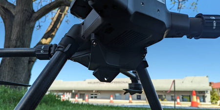
The launch of the weatherproof DJI Matrice 300 RTK was a turning point for the DroneUA team, which saw it as an opportunity to provide their energy customers with the right solution to minimise danger for humans and operate in harsh weather conditions. Yet, even with the help of a Matrice 300 RTK, there are significant risks and challenges that drone technology alone cannot solve:
Drones and ATVs to collect data in hazardous areas
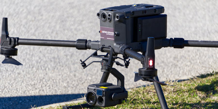
As part of the pilot project for DTEK, the Matrice 300 RTK was paired with a Sherp ATVs to allow for two specific missions for Ukraine’s largest private energy company:
- Transport a team of specialists across an adverse and inaccessible environment.
- Collect data in the most efficient way with the help of accurate cameras and imaging software
The drone inspection was planned to run along 2 km of power lines in the hard-to-reach area of Boryspil, a wetland in the Kiev region. The all-terrain vehicle was able to move the teams across the area and served as a launching pad for the Matrice 300 RTK.
The mounted thermal imager helped the inspectors digitise sections of the network that were previously difficult to access and identify the overheating spots on the towers that could trigger an unexpected shutdown. The DroneUA team relied on both manual flights and automated missions from inside the ATVs to generate 3D models and orthophoto maps - an approach that raised the interest of more energy companies and that is pushing Sherp to develop an integrated ATVs-drone solution for larger UN projects.
Matrice 300 RTK’s key power line inspection features
- OcuSync Enterprise -- The ability to rely on a powerful connection up to 15 km was exactly what they needed to cover the entire distance of the planned inspection.
- 55-minute Flight Time and Hot-Swappable Battery System -- To cover such a large area, the drone's flight time and the ability to quickly replace the battery were indispensable. When the drone’s charge was at a critical level, the team flew straight back to the vehicle, where the pilot and engineering team were able to change the batteries directly from the roof.
- 6 Directional Sensing and Positioning -- The power lines were adjacent to a dense forest and the M300 RTK’s omnidirectional collision avoidance helped prevent damage to the drone, trees, and the power lines.
- IP45 Rating, -20°C to 50°C Operating Temperature, and Wind Resistance -- The team was operating in rainy and windy conditions, with some occasional heavy precipitations, during which the drone offered the promised stability and endurance.
- AI Spot-Check and Waypoints 2.0 -- These features simplified post-processing of the collected data and helped professionals keep an eye on the most critical details.
- Advanced Dual Operator Mode -- The ability to transfer control to another pilot was crucial to ensure an uninterrupted, seamless inspection over a long stretch of power lines. In this case, the team used several pilots at different distances to extend the mission distance and eliminate any possibility of losing the drone.
- DJI Terra -- The fully integrated mapping software allowed the DTEK team to automate post-processing with a simple drag-and-drop workflow, directly from the payload. Thanks to the ease of use, DTEK was able to detect anomalies and dangerous areas on the network assets that had not been easy to inspect before.
Saving time and lives in high-risk power line inspections
As a result of the mission, the DTEK specialists received all the necessary data on the 2 km stretch in 1.5 hours instead of a typical 12-hour inspection with helicopters, considering the additional waiting time due to the unpredictable weather. The case study provided the teams with enough insights to scale the solution and implement it for the benefits of other energy companies and distribution assets with similar challenges, beyond their own region.
It is almost impossible to ignore the several benefits the mission produced for all those involved, and more importantly, for their energy client. But the ROI for this pilot project well exceeds numbers. In DroneUA’s words, it was the cooperation among all players engaged in a single task that made a difference -- which is sometimes more valuable than a standalone solution.