


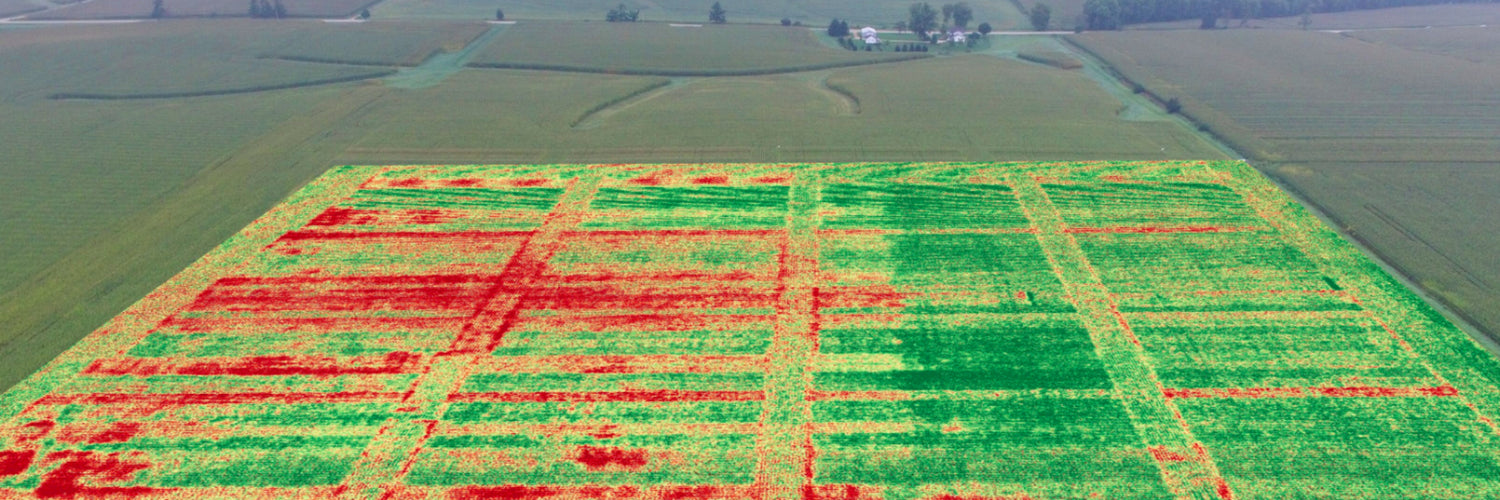
What is crop mapping?
Crop mapping is a process that is done throughout the life cycle of a crop. Drones are often used to map out the crops on a regular basis providing farmers with key data on how they are going. This data is then compared after each mapping run to figure out what to do next.
It is commonly used to figure out if there are enough pesticides on the crops, if the crops are getting enough nutrients, detect if there are any issues or animals affecting the growth, and more.
How does crop mapping work?
- A drone will be sent up by a farmer, equipped with a multispectral sensor, like the MicaSense RedEdge-P.
- The drone will be placed on an autonomous route over the crop field and begin to take photos every few seconds.
- Once done, the overlapping images will be processed and stitched together to create a map of the whole field, giving farmers the ability to see key information on their crops.
Benefits of using drones
- Data is captured at a much faster rate allowing for decisions to be made earlier on for improved crops.
- The cost of crop mapping is lower as a surveying aeroplane is no longer required.
- Data captured is of higher quality as the drone can be lower to the ground and move at a slower rate than a fast-moving aeroplane.
Image: DroneDeploy