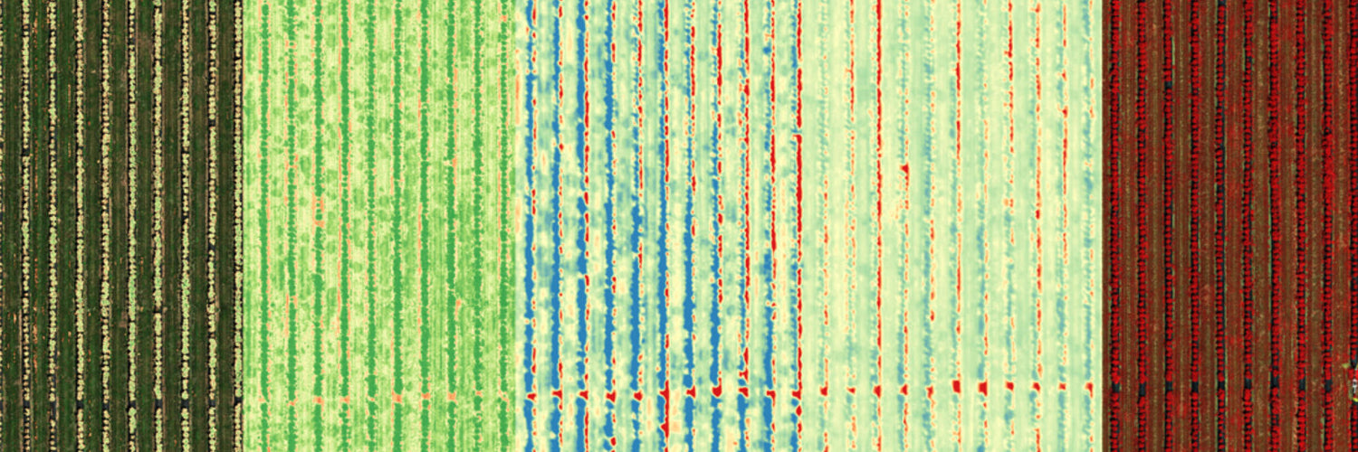
Multispectral collects electromagnetic data across a subset of targeted wavelengths at chosen locations and is often used throughout the agricultural sector when it comes to drones.
The history of multispectral imagery
Multispectral imagery was used as a part of NASA's focus on planetary science and mapping mineral deposits back on Earth and eventually, other planets. Since then, multispectral imagery has been brought closer to Earth through the use of drones, allowing high quality data to be capture around plant health, soil composition, pest monitoring, and more.
Multispectral drone sensors usually consist of around five or six spectral bands, which can include:
- Blue - 450–515..520 nm
- Green - 515..520–590..600 nm
- Red - 600..630–680..690 nm
- Near-infrared - 750–900 nm
- Mid-infrared - 1550–1750 nm
- Far-infrared - 2080–2350 nm
- Thermal infrared - 10400-12500 nm
Multispectral imagery in Australia: use cases (air, land, water)
Multispectral imagery is often used in the agricultural industry to monitor crops, pesticides, weeds, and pests. The primary use cases for multispectral imaging include the following:
- Crop Mapping
- Crop Health Monitoring
- Weed Mapping
- Soil Composition
- Pest Detection
- Pesticide Coverage
View all multispectral imagery use cases
The future of multispectral imagery
Multispectral imagery is often used throughout the agriculture industry with drones and the related sensors improving utilisation. As more sensors are released and the price for the technology continues to decrease uptake will increase.
Image via MicaSense