DJI
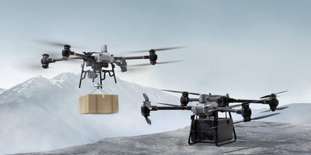
DJI has announced its first low-altitude delivery drone solution, DJI FlyCart 30. FlyCart 30 supports package deliveries of up to...
DJI has released an update to its DJI Terra taking it to version 3.5.0. This new update brings improvements to point...
DJI has released its latest top of the range camera gimbal, DJI RS 3 Pro, featuring carbon fibre construction, LiDAR-based...
DJI released a new firmware for the DJI Matrice 300 RTK drone adding support for the new DJI Pilot 2...
Malaria is an ancient disease that continues to devastate some of the world’s most vulnerable communities. In 2019, an estimated...
Data security is a major part to all drone operations with the large amount of important and confidential data being...
DJI has released the second major version of its enterprise drone app, DJI Pilot 2. The app update brings improvements to...
With an RTK drone, surveyors and other kinds of enterprise drone pilots can expect centimetre-level positioning accuracy with each flight....
Whenever you need to create a detailed model of an area — for surveying, accident reconstruction, or any other purpose...
Everything is fine until it’s not. Regular inspection of power lines is one of the first mandates of an energy...
To understand how drones can be utilised in surveying, let us remind you quickly about aerial photogrammetry. It involves taking...
After a traffic accident, first responders are faced with two simple questions: what happened and why? Accident reconstruction is all...
Despite COVID‑19-related delays and temporary halts in construction, renewables are on track to overtake coal to become the largest source of electricity...
On the morning of January 4th, 2021, a drone specialist arrived at a section of an SNCF railroad to test and compare...
Drones are taking on role of helping us save the environment thanks to their capabilities, feature sets, and opening new possibilities....
DJI has released a new firmware update for its DJI RS 2 & RSC 2 gimbals, adding support for the BMPCC 6K...
Drones are beginning to take up a bigger role in protecting and tracking animals, helping environmentalists do their job. These conservation...
In November 2018, a devastating fire swept through Paradise, California burning much of the town and totalling at a huge 153,336 acres...
Over the years drones have stood out in a few industries, with firefighting being one of them. Drones have the...
The Matrice 300 RTK platform is designed with extensive system and sensor redundancies to maximise flight safety and reliability. These...
DJI has released a fix for its Mini 2 drone, fixing the battery discharge issue that was first found a...
DJI has released an update for its recently released DJI FPV drone adding new features and fixing bugs present in...
Inspections are among the fastest growing uses of drones, with acceleration from improved sensors, payloads, and drones mixed with the...
The Zenmuse L1 from DJI is the company's latest LiDAR and RGB solution for aerial surveying. The payload combines a...
Interested? Talk to our team
For inquiries or more information, please fill out the form below, and our team will contact you as soon as we can.


