On the morning of January 4th, 2021, a drone specialist arrived at a section of an SNCF railroad to test and compare different surveying methods. In the past, to get results accurate to 3cm, 40 ground control points (GCPs) per square kilometre would have to be set up - a time-consuming practice that would take at least 3 hours. The alternative option would have been to use a highly accurate tacheometer, but again, this would take twice as long to complete.
Both these techniques also require the in-person handling of equipment on and around the railway tracks, which not only poses certain risks for the operator but also takes a lot of time and effort as the complex railway terrain is also extremely difficult to map accurately. Time and safety are essential factors for a successful surveying operation, which is why innovative surveying methods can lead to a considerable competitive advantage.
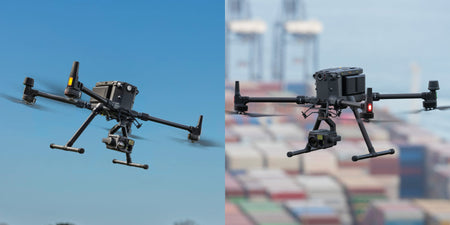
That is why Altametris wanted to test the DJI Matrice 300 RTK and the Zenmuse P1 payload. Given the tedious nature of traditional methods, the company was hoping for great efficiency and safety gains through the deployment of a drone surveying solution. Due to its built-in RTK module and the substantial number of metadata that is intelligently linked to the centre position of the Zenmuse P1's full-frame sensor, the number of GCPs could technically be reduced to zero. However, Altametris decided to set up six GCPs for quality control purposes, which still reduced the time it took to prepare the operation by more than two hours.
A highlight in low light
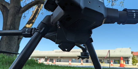
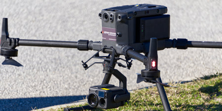
While the DJI Matrice 300 RTK lays the groundwork for an airborne mapping and surveying solution, the Zenmuse P1 payload and its full-frame sensor take operations to the next level.
On the day the site was to be mapped, the available light was quite low, which is why six (6) GCPs were initially set up. After everything was prepared, the specific area to be mapped was selected on the drone controller and the DJI Matrice 300 RTK with the Zenmuse P1 payload was launched. Within 20 minutes, the Zenmuse P1, with its mechanical shutter, automatically took a total of 641 pictures from up to five different angles (front, left, right, top and rear) on every checkpoint.
Receiving this amount of data in such a brief period of time is made possible by the Smart Oblique Capture mode of the Zenmuse P1 payload. The camera automatically tilts and rotates on each checkpoint to capture a comprehensive set of pictures of every angle. This feature in connection with the pre-planned flight routes lets the operator execute a whole drone mapping operation at the push of a button while standing at a safe distance. And the drone operator did exactly that even though the lighting conditions were still not optimal.
To the surprise of Altametris, the low light did not affect the picture quality at all. Instead, the Zenmuse P1 produced incredibly accurate data thanks to its full-frame sensor. The pictures showed no noise whatsoever, which was critical because, at such a high altitude, a higher ground sample distance and even a few pixels of noise would equate to several centimeters on the ground, and therefore much decrease the accuracy of the final model.
The M300 RTK + P1 package provides the quality and time savings to meet ever more demanding photogrammetry needs. - Quentin Lemesle, Altametris
Conclusion
For Altametris, the time and cost savings are especially important factors – DJI performing the task up to fifteen times faster and four (4) times cheaper than the alternatives make perfect business sense to implement a drone surveying solution. However, they are not the only important achievement of such a solution:
For the operators, site safety is a major concern as well. This is massively improved by being able to collect all the data from a secure distance to safety hazards, one of which is the current COVID pandemic that can be a risk factor when surveying crowded sites, like buildings, in person.
The DJI Matrice 300 RTK is not only a tool for gathering intelligence on sites to be surveyed. It goes beyond that by improving the mapping process in every aspect through increased safety, speed, scalability, and automation, thus delivering an unparalleled solution that is quickly establishing itself as the new industry standard in surveying and mapping.
Source: DJI