


Freeport-McMoran, Inc. is a leading international mining company with headquarters in Phoenix, Arizona. Freeport-McMoran, Inc. is the world’s largest publicly traded copper producer.
The need
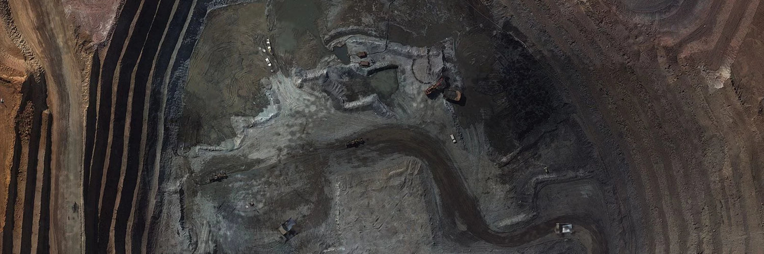
Freeport-McMoRan operated the copper mine at Tenke Fungurume (TFM) in the Katanga Province of the Democratic Republic of Congo. TFM’s mining activities include surface mining, leaching, and SX/EW operations. They need weekly topographical surveys to calculate the production capacity and generate digital surface models (DSM) of the mine.
Normally these observations are made by surveyors on foot and require the mining operations to cease. This kind of interventions present a danger to the surveyors, and do not always generate the most accurate measurements. Additionally, at an average size of 400ha, gathering the data from these mines is often time consuming and tedious task.
The solution
To address TFM’s needs, Delair used their DT18 HD drone package to create 2D and 3D maps of the mine. Then, Delair used the capacities of its cloud-based data processing platform to extract the most useful pieces of information: cubature (volume) calculations, digital surface models (DSM), and high-resolution ortho-mosaics. Since Delair’s drone and data solutions are turn-key, they allow companies like Freeport-McMoRan to easily invest, deploy, and obtain business insights from these next-generation aerial observation platform.
The operation
Putting the data to work. Thousands of images were captured by the DT-18 HD during the flights in DRC. The images were analysed by Delair’s photogrammetry experts which use proprietary algorithms developed specifically for the needs of large, industrial end-users:
- Volume calculations
- Creation of contour lines
- Pre- and post-mining imagery of land disturbance
- Creation of 2D orthomosaic and 3D models of the mines, compatible with AutoCAD-based software or MineSight (.shp or .dxf ) at 4.5cm GSD with a Z precision of 9cm
A report that indicates the mine volumes, changes over time, and contour line maps were created and delivered. A web visualisation tool through the Delair cloud-based platform for viewing and archiving past results was set up. Integrating the data into Freeport-McMoRan’s own mining software (AutoCAD, MineSight, etc.) was possible thanks to the Delair’s results compatibility.
Source: Delair