Couldn't find what you were looking for?

We'd be happy to help out! Get in touch using the enquiry form below.


Delair

Surveillance drones safeguard oil fields against security threats and revenue loss


Some of the biggest conventional onshore reserve discoveries are in remote and hostile areas, creating a need to improve security...

Drones adopted in agribusiness: cost evaluation for a drone solution


Drones and low altitude aerial imagery have paved the way for new applications, significantly reducing costs and increasing the efficiency...

How to fly your agriculture drone to get accurate plot data


Reaching data accuracy on your experimental fields requires to fly the right drone, at the right time, with the right...

RTE relies on Delair DT26X LiDAR drone for power line inspection


RTE oversees maintenance and repairs for over 100,000 km of electricity power lines in France. When they started to consider...

How fixed-wing drones address the challenge of large-scale surveying for mines


For large-scale surveying and asset management in remote areas, drone-based data collection is often the only option. Engineering services company...

How agricultural drones deliver enhanced scientific services to the seed oil industry


Innolea, ex Biogemma, is a research company supporting the French oil industry, with activities focused on oil crop genetics and...

Copper Mine Survey & volume calculation with drones


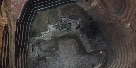
Freeport-McMoran, Inc. is a leading international mining company with headquarters in Phoenix, Arizona. Freeport-McMoran, Inc. is the world’s largest publicly...

Drone inspection of anomalies around underground pipelines


GRTgaz, a subsidiary of Engie, is a natural gas transmission system operator. GRTgaz has over 4 400 delivery stations in...

How Eurofins is evaluating Delair drones and data management platform delair.ai for agricultural research


Providing sustainable solutions for global food security is a major challenge. With the world population estimated to grow to nearly...

Riverbank mapping for flood monitoring with drones


DDT-31 is a French Department of Territory Management. DDT stands for Direction Départamentale des Territoires, with the "31" referring to...

Simplifying vegetation management for power lines with drones


Trees that are too close to power lines are a significant hazard and a major cause of power failures during...

How drones uncovered archaeological features


It took the team about three days to be fully operational with the UX11. They trained themselves by reading the...

3 ways a long-range drone will optimise your agriculture business


The world of smart farming brings precise inventories, harvest predictions and fast disease control to your fingertips. Find out three...

The long-term value of adopting drones for more efficient engineering services


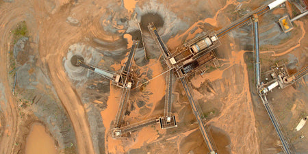
To say Johnson Poole and Bloomer (JPB) has a deep history in the mining industry is more than just a...