


Blog
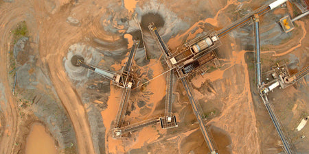
To say Johnson Poole and Bloomer (JPB) has a deep history in the mining industry is more than just a...

During the opening ceremony for the Tokyo 2020 Olympic Games over one thousand drones made an appearance, lighting up the sky...

Rules for recreational drone operators You must not fly your drone higher than 120 metres (400 feet) above ground level....

We recently shared that CASA had delayed its drone registration levy from its original introductory date of 1 July 2021. CASA...

Remote inspections are carving a path through the next phase of marine digitalisation, providing owners and operators with new ways...

Despite COVID‑19-related delays and temporary halts in construction, renewables are on track to overtake coal to become the largest source of electricity...

Large tanks are used to manufacture pharmaceutical products at scale. These tanks are made from stainless steel as they are easy...

There are many questions asked around thermal payloads for drones. Teledyne FLIR has answered some of these questions below. Q:...
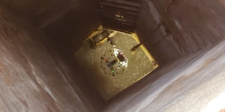
As a part of its everyday work at, Suez RV Osis, a French water and waste management company inspections of its sewer...

On the morning of January 4th, 2021, a drone specialist arrived at a section of an SNCF railroad to test and compare...

Drones are taking on role of helping us save the environment thanks to their capabilities, feature sets, and opening new possibilities....

DJI has released a new firmware update for its DJI RS 2 & RSC 2 gimbals, adding support for the BMPCC 6K...

Drones are beginning to take up a bigger role in protecting and tracking animals, helping environmentalists do their job. These conservation...

Bridge inspections are a crucial part of ensuring proper maintenance for critical infrastructure. These inspections help uncover potential defects in a...

One of the more challenging inspections that Simon Kumm, Managing Director of InspecDrone, has performed is of a hydrogen reformer...

In November 2018, a devastating fire swept through Paradise, California burning much of the town and totalling at a huge 153,336 acres...

Over the years drones have stood out in a few industries, with firefighting being one of them. Drones have the...

The Matrice 300 RTK platform is designed with extensive system and sensor redundancies to maximise flight safety and reliability. These...

DJI has released a fix for its Mini 2 drone, fixing the battery discharge issue that was first found a...

Canadian oil and gas companies must reclaim and monitor inactive resource extraction sites for many years after operations are completed....

DJI has released an update for its recently released DJI FPV drone adding new features and fixing bugs present in...

Sony plans to release its Airpeak S1 professional-use drone, the first in the Airpeak line, later this year in September....

Inspections are among the fastest growing uses of drones, with acceleration from improved sensors, payloads, and drones mixed with the...

In the commercial market there are a large number of 3D modelling software available to use with your drone. When...
Interested? Talk to our team
For inquiries or more information, please fill out the form below, and our team will contact you as soon as we can.