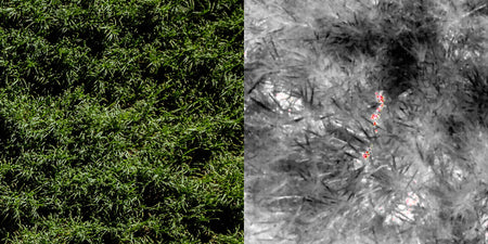
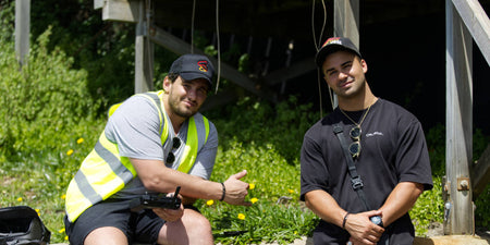
A leading energy asset management company was seeking a robust and reliable drone platform to enhance their surveying capabilities for a critical project in coastal South Australia.
Brief
Their goal was to streamline the production of high-quality survey data, including point clouds, digital elevation maps, and orthomosaic maps. Given the challenging coastal terrain and the need for precise geospatial data, the company required a drone solution that could meet specific technical and operational demands.
Key requirements included:
- High-precision data capture: The ability to produce accurate survey-quality point clouds and digital elevation maps.
- Efficient mapping capabilities at scale: A platform that could handle large areas quickly, without sacrificing data quality.
- Reliability in challenging environments: A drone that could perform consistently in coastal conditions with varied terrain.
- Seamless integration with software: Compatibility with industry-standard mapping and post-processing tools to ensure efficient data handling.
- Ease of use and deployment: A user-friendly platform that could be deployed rapidly and operated efficiently by their team.
Existing method
The leading energy asset management company used traditional surveying methods for producing survey-quality point clouds, digital elevation maps, and orthomosaic maps. This involved manual processes, requiring significant time, effort and resources. These approaches, while accurate, are less efficient and more prone to human error compared to modern drone-based techniques.
- Relied on total stations, GPS, and ground-based LiDAR for data collection.
- Surveyors had to set up equipment at multiple points, especially in challenging terrain.
- Photogrammetry required manual photography and processing.
- Data collection was slow, labour-intensive, and difficult in large or remote areas.
- Increased potential for human error with repetitive setups and measurements.
Solution

Choosing the Drone
The customer was looking for a reliable and stable drone platform with long flight time to capture as much data as possible in a single flight. After personalised consultation with the client, we worked through the potential options and leveraging the deep technical knowledge of Sphere Drones staff, the customer landed on the DJI Matrice 350 RTK with its 55-minute flight time, 20km transmission range, and multiple safety redundancies built-in.
About the DJI Matrice 350
The DJI Matrice 350 RTK is an advanced drone platform that redefines industry standards with its cutting-edge technology and versatility. Featuring an upgraded video transmission system, enhanced control experience, and a more efficient battery system, making it ideal for extended and demanding operations.
With comprehensive safety features, robust payload capacity, and extensive expansion options, the Matrice 350 RTK is designed to empower a wide range of aerial applications. Whether for surveying, inspections, or emergency response, this drone delivers innovative performance and reliability to tackle any challenge in the field.
Key specs
- 55-minute flight time.
- 20km transmission range with DJI O3 Enterprise.
- Propeller arm lock with take-off prevention.
- 1080p night vision capable camera.
- New batteries with add support for hot swapping and 400 charge cycles.

Choosing the payload
The customer stressed the importance of the data being precise and accurate, as coming back to re-collect it wasn’t an option. This enforced the M350 and L2 as the solution, thanks to its ability to display the point cloud in real-time, ensuring the correct data was captured. Our team also suggested the inclusion of DJI’s D-RTK 2 base station, which provided the customer with centimetre-level accuracy.
About the DJI Zenmuse L2
The DJI Zenmuse L2 is a cutting-edge LiDAR sensor that integrates advanced LiDAR technology, a high-precision IMU system, and a powerful 4/3 CMOS RGB mapping camera. Designed for seamless integration with DJI’s Matrice 350 and Matrice 300 platforms, the L2 enables precise, efficient, and reliable geospatial data acquisition.
Key specs
- The upgraded IMU boosts yaw, pitch, and roll accuracy while eliminating IMU warm-up time for faster deployment.
- With support for a higher number of returns, the L2 captures more data beneath tree canopies and offers two scanning modes to suit your needs.
- The L2 boasts a 30% increase in detection range and captures up to 240,000 points per second, providing richer and more detailed point clouds.
- Equipped with a new 4/3 CMOS RGB camera with a mechanical shutter, the L2 delivers improved mapping results and more accurate colourised point clouds.

Choosing the software
The customer was looking for a software solution that would work seamlessly with the Zenmuse L2 from DJI while generating high quality processed data. We knew DJI Terra would be the perfect piece of software for the job, thanks to its streamlined workflow with DJI’s payloads, it’s ability to intake RGB, LiDAR and multispectral data, and even able to send files to DJI Modify for further processing.
About DJI Terra
DJI Terra is advanced 3D model reconstruction software, built around photogrammetry technology. It offers precise and efficient 2D and 3D reconstructions using visible light, LiDAR and mulitspectral data. Designed to seamlessly integrate with DJI Enterprise drones and payloads, DJI Terra creates a complete solution for various industries, including land surveying, mapping, power transmission, emergency services, construction, transportation, and agriculture.
Result
After completing a test project and familiarising themselves with the M350 and L2, the customer confidently used the combination in over 80 flights, lasting round 25 minutes each over a week-long period to capture over 650GB of LiDAR and photographic data.
The M350 and L2 allowed the customer to increase its mapping efficiency and data capture rate while ensuring the data quality remained high, with the L2’s ability to display a point cloud in real-time playing a big part in ensuring the required data was captured.
Key improvements include:
- Increased efficiency: A high number of flights were completed within just one week, significantly speeding up the mapping process.
- Higher data capture rate: The drone captured over 650GB of LiDAR and photographic data in short 25-minute flights.
- Real-time point cloud display: The L2’s ability to display point clouds in real-time ensured that the required data was captured accurately on the spot without the need for additional flights.
- Consistent data quality: Despite the rapid capture, the quality of data remained high throughout the project.


