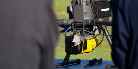
In the rapidly evolving field of surveying, the integration of Light Detection and Ranging (LiDAR) technology has emerged as a game-changer. This sophisticated tool, combined with drone technology, offers unparalleled precision and efficiency, transforming how we capture and analyse spatial data.
In this article, we'll delve into the basics of LiDAR, look at its applications in surveying, and show you how it is reshaping industry standards.
Understanding LiDAR technology
At its core, LiDAR is a remote sensing method that uses laser pulses to measure distances. It operates by emitting rapid pulses of laser light towards the ground and measuring the time it takes for each pulse to bounce back to the sensor.
These measurements are then used to create detailed, three-dimensional maps of the surveyed area.
LiDAR system components
| Component | Function |
|---|---|
| Laser Scanner | Emits laser pulses and collects the reflected signals. |
| GNSS Receiver | Provides precise location data for the scanner. |
| Inertial Measurement Unit (IMU) | Tracks the orientation and movement of the scanner to ensure accurate data collection. |
LiDAR and drone technology: A perfect pair
When combined with drones, LiDAR technology becomes even more powerful. Drones equipped with LiDAR sensors can capture high-resolution data from aerial perspectives, offering several key benefits:
| Benefit | Description |
|---|---|
| Highly Accurate | LiDAR’s precise measurements combined with a drone’s stable flight platform ensure exceptional data accuracy. |
| Time Efficient | Drones with LiDAR complete surveys rapidly, reducing fieldwork hours and accelerating project timelines. The post-processing time required for LiDAR is also generally markedly reduced. |
| Site Coverage | Drones can cover large areas quickly, ideal for huge site or survey locations or hard-to-reach locations. |
Applications in surveying
The applications of LiDAR technology in surveying are diverse and impactful. Here are some key areas where LiDAR is making a significant difference:
| Advantage | Description |
|---|---|
| Topographic Mapping | Provides highly accurate elevation data for creating detailed topographic maps. |
| Infrastructure Monitoring | Monitors the condition of infrastructure like bridges and roads, detecting potential issues early. Useful in the event of failure events e.g. landslides where normal access is not possible. |
| Forest Management | Measures ground elevation through vegetation, aiding in forest assessment. Also used for Biomass quantification e.g. Carbon monitoring, health and or size of trees canopy |
| Archaeological Surveys | Reveals ground features hidden beneath vegetation, uncovering ancient structures. |
Advantages Over traditional methods
LiDAR technology offers several advantages over traditional surveying methods:
| Advantage | Description |
|---|---|
| Precision | Laser pulses provide extremely accurate distance measurements. |
| Speed | Drones cover large areas quickly, speeding up the surveying process. |
| Safety | Accesses hazardous or difficult terrain without putting surveyors at risk. |
| Cost-effectiveness | Initial investment is high, but efficiency and accuracy lead to long-term cost savings. |
LiDAR technology, particularly when used in conjunction with drones, is revolutionising the surveying industry. Its ability to provide highly accurate, detailed, and timely data is transforming how surveys are conducted, offering significant benefits in terms of precision, efficiency, and safety.
As technology continues to advance, the integration of LiDAR and drones is set to become increasingly prevalent, further enhancing the capabilities of surveyors and paving the way for new possibilities in spatial analysis.
For those involved in surveying, embracing LiDAR technology is not just a step forward—it's a leap into a new era of data accuracy and operational efficiency.
To date, Sphere Drones has helped more than 11,000 clients, including 3,000 corporations – in the procurement or rental of drones, parts and accessories, software, and training and support for airborne and underwater drone operations.
Get in touch with our team using the form below to discuss LiDAR and how it could fit into your operations whether you’re just starting out or are more experienced.


