Cart

Your cart is empty.
Couldn't find what you were looking for?

We'd be happy to help out! Get in touch using the enquiry form below.

How Eurofins is evaluating Delair drones and data management platform delair.ai for agricultural research

Published by Josh Spires on 24 August, 2021, updated on 01 March, 2022.

How Eurofins is evaluating Delair drones and data management platform delair.ai for agricultural research

Providing sustainable solutions for global food security is a major challenge. With the world population estimated to grow to nearly 10 billion people by 2050, the demand for agricultural products will increase by up to 50%.

Weed, pest and disease control, as part of a wider Integrated Crop Management (ICM) is vital to help achieve sustainable food security – for families today and generations of the future. This is one of Eurofins AgroScience Services’ key missions; to support the AgroScience industry by producing new effective and scalable solutions.

As part of the Eurofins Scientific Group, Eurofins AgroScience Services is a global research organization providing regulatory & technical support to the agrochemicals and biologicals manufacturers, breeders, animal health and agtech industries. The company offers the full portfolio of services required to screen and develop, register, and steward new products for agriculture, including efficacy, safety field and laboratory studies, regulatory consultancy, and project management.

In 2019, Eurofins AgroScience Services has conducted the Aerial Potato Disease Evaluation (APODE) European project together with Delair and GeoInspect, evaluating an agricultural drone solution to screen one of the most serious diseases of potatoes in the world: late blight (Phytophtora infestans). This project has received funding from the EU Horizon 2020 DIVA project.

The challenge for agriculture research

Twenty-one million hectares of potatoes are cultivated in the world and late blight pathogen is estimated to cost more than one billion euros per year in Europe, and seven billion euros globally. Each year, European crop protection research companies are running thousands of trials on potato blight to evaluate new fungicides. The official disease evaluation method consists in estimating the plant foliar infected area at frequent intervals over the whole crop cycle. his method represents hundreds of days and researchers and generates terabytes of data collected from visual field evaluations.

For agchem manufacturers, this data is key to elaborate and demonstrate new treatments as fungicide resistance has been reported in an increasing number of countries, and growers trying to control late blight and early blight are facing increasing difficulties.

Plant protection research companies such as Eurofins are therefore looking for new effective technologies to gain both time and accuracy in their experiments.

“Collecting large-scale, field-based plant data with sufficient accuracy and in a reproducible and objective manner, represents a real challenge in the plant science research, it can also be very labor intensive and costly, “explains Emilie Guillard, Director of Innovation at Eurofins AgroScience Services in France.

As a global leader in plant protection research, Eurofins Agroscience services invests in collaborative projects to improve field testing methods and benefit from digital technologies. Delair drone solutions are already successfully used by breeders for phenotyping, as they standardise the data acquisition and provide full field traceability. Eurofins looked at transferring this technology to large scale crop protection experiments, such as their potato blight microplots platforms spread across Europe to evaluate new fungicide solutions.

An end-to-end visual data management solution

Eurofins has started to use Delair’s drone data management solutions during the summer of 2019 to automate and improve the quality of their field trial evaluations. They needed a complete, end-to-end solution including hardware and software to achieve their research goals: assess potato late blight evolution over three months, collect accurate and objective data, ensure traceability and compliance with EU guidelines, and improve team efficiency.

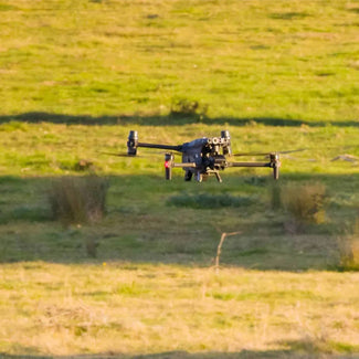
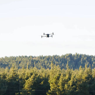
Once the decision was made to collaborate with Delair on this research project, the Eurofins teams went quickly through the adoption process and first results. After a three-day training in June 2019, Eurofins and GeoInspect pilots flew over 400 potato microplots in Ireland and France from July to September with the Delair UX11 Ag drone.

The Delair UX11 Ag was adapted to Eurofins data collection needs. Designed for BVLOS (beyond-visual-line-of-sight) flights, the system reduces the amount of time and money required to provide detailed surveys of large-scale agriculture operations. For these specific conditions – potato blight monitoring – the UAV can cover 50 ha (124 ac) per flight at 70m (230 ft), in less than one hour.

The drone was also appreciated for its ease-of-use: in less than 5 minutes, the flight’s parameters can be adjusted by the pilot according to meteorological conditions, plot’s characteristics, or flight elevation. The whole experience is made easy thanks to the UAV’s Android mission planning and monitoring app, which includes a pre-flight checklist, no-fly zones, modern user interface, and in-flight data.

Of high interest for Eurofins was the embedded MicaSense RedEdge MX camera, a fully integrated high-grade multispectral sensor to see at the plant level. The sensor generates plant health indexes and RGB (color) images and is calibrated for precise, repeatable measurements. Thanks to its PPK-as-you-go feature, it was also possible to precisely overlay the aerial maps for temporal data analysis, flight after flight.

In the end, Eurofins field agronomists were able to extract potato crop measurements at microplot level and compare fungicides responses between the different microplots. Eurofins got the data collected and processed in the delair.ai platform, with ag-dedicated algorithms to automatically generate online and sharable maps.

Source: Delair

Interested? Talk to our team

For inquiries or more information, please fill out the form below, and our team will contact you as soon as we can.

Interested? Talk to our team

For inquiries or more information, please fill out the form below, and our team will contact you as soon as we can.

Download brochure

Download technical specifications